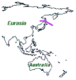
Structure of the Crust at the region of the geotraverse was
received from reinterpretation of data of 11 Deep Seismic
Sounding profiles
that are disposed at the area of geotraverse and neighboring areas.
Seven from the profiles - 18, 19, 20, 27, 28, 29 and 30
- are located near
shores of Sakhalin. Institute of Earth Physics and Sakhalin Integrated
Institute carried out the seismic works along these profiles in 1963 - 1964
years. Four profile - 1M, 1O, 6M and 6O - are disposed
in region of Kuril
Trench and Kuril Basin. The seismic measurements along them were made in
the period of International Geophysical Year in 1958 - 1959 by Institute of
Physics of Earth of Academy of Sciences of USSR. The seismic works were
made at most high level for that time. Over 20 profiles were investigated
in that period.