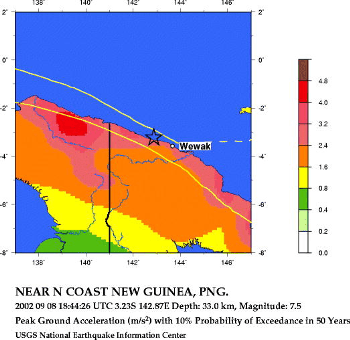
Сейсмотектонический обзор о районе
землетрясения 8 сентября 2002 г. (18:44 UTC)
По данным NEIC, USGS
Seismic Hazard Map
This earthquake occurred in a subduction zone environment near the eastern
end of the New Guinea trench off the north-east shore of the island of New Guinea,
Papua New Guinea. It resulted from stresses developed by the complex interaction
between three tectonic plates specifically, the large Pacific and Australian plates
and the small Bismarck micro plate. Relative to New Guinea the Pacific plate is
moving west-south-west at a rate of about 10 cm per year and underthrusting both
the Bismarck and Australian Plates.
This region has recently suffered several damaging earthquakes. Most
significantly, on July 17th, 1998 a tsunami generated from an magnitude 7.0
earthquake killed at least 2,183 people and injured thousands.