 United States
National Seismograph Network
United States
National Seismograph Network
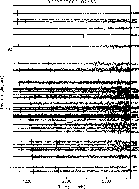
Seismograms for 2002 June 22 UTC
To view the data, select a Station below / Для просмотра данных выберите станцию
| Station | Location |
| AAM | Ann Arbor, Michigan, USA |
| ANMO | Albuquerque, New Mexico, USA |
| BLA | Blacksburg, Virginia, USA |
| BW06 | Boulder Array, Wyoming, USA |
| CBKS | Cedar Bluff, Kansas, USA |
| DUG | Dugway, Utah, USA |
| ELK | Elko, Nevada, USA |
| HLID | Hailey, Idaho, USA |
| HWUT | Hardware Ranch, Cache County, Utah, USA |
| ISCO | Idaho Springs, Colorado, USA |
| JFWS | Jewell Farm, Wisconsin, USA |
| LSCT | Lakeside, Connecticut, USA |
| LTX | Lajitas, Texas, USA |
| MCWV | Mont Chateau, West Virginia, USA |
| MIAR | Mount Ida, Arkansas, USA |
| MNV | Mina, Nevada, USA |
| MYNC | Murphy, North Carolina |
| OXF | Oxford, Mississippi, USA |
| PAL | Palidases, New York, USA |
| PLAL | Pickwick Lake, Alabama, USA |
| SSPA | Standing Stone, Pennsylvania, USA |
| TPNV | Topopah Spring, Nevada, USA |
| WCI | Wyandotte Cave, Indiana, USA |
| WMOK | Wichita Mountains, Oklahoma, USA |
| WUAZ | Wupatki, Arizona, USA |
| WVOR | Wild Horse Valley, Oregon, USA |
На основную страницу Список землетрясений
URL: http://zeus.wdcb.ru/wdcb/sep/strong/20020622/wave_us.htmlLast revision June 27, 2002