Сейсмотектонический обзор о районе
землетрясения 31 марта 2002 г. (06:52 UTC)
По данным NEIC, USGS
This thrust earthquake occurred off the north-east shore of the island of Taiwan in a tectonicly complex
region known as the Taiwan Collision Zone. This region is highly seismic. There are an average of five earthquakes
per year with magnitude 5 or greater occurring within a 1 by 1 degree zone surrounding the epicenter.
The high seismicity results from the convergence of the Philippine Sea plate and the Eurasian plate.
The Philippine plate is moving NW at a rate of about 7 cm per year relative to the Eurasian plate.
The complex region near the epicenter contains several substantial tectonic features including, the
Ryukyu trench, Manila trench, and the Okinawa trough.
Given the earthquake's fault mechanism and depth, it likely resulted from slip on the boundary between the subducting
Philippine plate and the overlying Eurasian plate (see the cross-section link to the left). The surface expression
of this contact is the east-west trending Ryukyu trench which is about 200 kilometers southeast of the epicenter.
The tectonic environment of this earthquake differs from that of the more destructive magnitude 7.7 earthquake that
occurred on September 20, 1999; the latter earthquake occurred in the crust of the Eurasian plate within the island
of Taiwan.
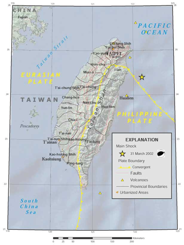
Plate tectonics map
URL:
http://zeus.wdcb.ru/wdcb/sep/strong/20020331/stect.html
Last revision April 10, 2002